|
||||||
|
Mining continued
into the nineteenth century but the town began to die. By 1912, its
post office had closed.
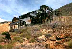
Today, the Golden Gem Mill and head
frame still stand among scattered debris. Nothing else is left of this
once vibrant city.
According to some reports, caution should be utilized in
exploring this area as there is a deep, uncovered shaft not far from the
base of the mill.
Cerbat is nine miles northwest of
Kingman on U.S. 93 at a historical marker
near Milepost 62. Here, you get off the highway on a dirt road,
heading east for 0.7 mile, then left for 0.6 mile, then right again for
another two miles. The last stretch of this road requires a high
clearance vehicle or a willingness to walk.
Named for the
rich minerals in the juniper-filled basin at the foot of Ithaca Peak,
Mineral Park was founded in 1871. Growing quickly the settlement
soon had almost 700 residents, becoming the biggest settlement in the
county. A post office was established on December 31, 1872. Just a year later,
Mineral Park took the title of county seat from nearby
Cerbat.
|
||||||
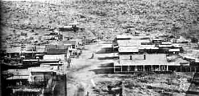
Mineral Park
Arizona, 1880, courtesy Mohave Historical
Society
|
||||||
|
In
addition to the mines of the area, the town became a supply point for more
distant mines and a growing number of cattle ranches. Ready to last
the duration the town soon had an assay office, five smelters, a hotel, a
restaurant, several stores and a number of saloons. Two stagecoach
stations were present in
Mineral Park and in 1882; a weekly newspaper called the Mohave
County Miner began. In 1883, Mineral Park prospered further when the Atlantic and Pacific Railroad
was completed just 20 miles to the south. This cut the costs of
transporting ore and supplies dramatically.
However, what Mineral Springs didn’t count on was the small
settlement of
Kingman, built to service the railroad,
would begin to grow so fast. In spite of the
Mohave County Miner's best efforts
to downplay the possibility of
Kingman ever amounting to much, over the
next five years,
Kingman continued to prosper as a supply
center for the area mines, as well as a commercial center for travelers
through the area.
|
||||||
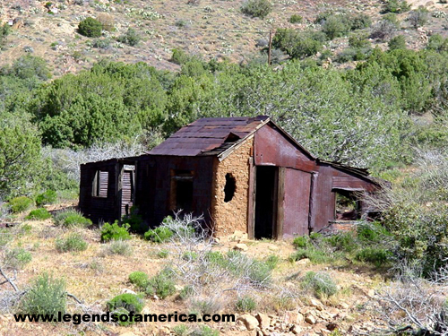
Mineral Park today has very little left,
April, 2005.
|
Soon, Mineral Park was to experience more civic embarrassment when a
county-wide vote made
Kingman the
new county seat in 1887.
Kingman got
271 votes to Mineral Park's 93. Even Hackberry, located some 30 miles
northeast of
Kingman got more votes than Mineral Park at 132. Many speculated that
Mineral Park merchants, who already had some economic connections with
Kingman,
were interested in reducing their costs by being closer to the railroad.
Despite the conclusiveness of the polls,
Mineral Park officials refused to give up the county records. Outraged,
Kingman citizens subsequently raided the town hall and made off with
the county documents, literally "taking” the county seat.
The Mohave County Miner, once the
biggest critic of moving the county seat to
Kingman,
gave in to economic reality and made the move from Mineral Park to the new county seat of
Kingman.
|
|||||
|
Losing the
county seat was just the beginning of the end for Mineral Park. After 1887, some of the mines began to close.
Though some were reopened briefly in the early 1900s, the town never
recovered and its post office closed for good on June 15, 1912. Today Mineral Park has all but vanished and sits upon private mining property where turquoise and copper are still being mined from the area. An open-pit mine, formerly operated by the Cypress-Bagdad, has caused once-prominent Ithaca Peak to disappear completely. The area is scattered with the debris of earlier days, where head frames, mill foundations and tattered cabins can still be seen amongst the mine tailings. Mineral Park's small cemetery is one of the best-preserved in Arizona. Although it is within mine property, it can still be viewed by contacting the current mining operation.
To get to Mineral Park, you will travel some 14 miles northwest of
Kingman on
US 93 to a turn-off between Mileposts 58 and 59. Here, there is a
historical marker where you will turn east for 4.3 miles on paved road,
then left 0.3 mile on a well-used gravel road (the turn is just before the
fenced-in modern mine.)
| ||||||
Monday, March 16, 2015
The Cerbat Mountain Range, Kingman Arizona

Subscribe to:
Post Comments (Atom)
No comments:
Post a Comment